
A Utah Loop

The Distance from Blanding, Utah to Bluff Utah is only about 25 miles but if you plan carefully you can make it in 200. I had planned carefully... I had planned to be responsible, put in a day and and drive from Blanding to Torrey. After all The previous day I had driven 120 miles and landed 21 miles from my starting point... I needed to make "progress" gol darn it! and 175 miles farther down the road was furthering my cause. I was less than two blocks down the road when I saw a sign that read "Mexican Hat 50 miles."

Mexican Hat! Just the day before I was talking to a couple & heard about a really cool road between Mexican Hat and Natural Bridges... I gotta go that way! ......And then... 15 miles down the road to Mexican Hat I saw a sign that pointed to Hovenweep National Monument. "Oooh, what's that?" Cried the hopelessly digressive airhead in the car, "That sounds interesting..." and the corner was turned without another thought. But my thinking muscle came back on line & realized the sign didn't say how far this National Monument was. Time to pull over & check out the maps.

For me, maps are dangerous things. they lift the veil to the unknown.... but only just a little. They tell me that this is over there, but not exactly what this is. If you really want to know you have to google it (ha ha ha) even better go there... and maps are full of really useful information too. Such as: how far away is that unknown place. the map told me that Hovenweep National Monument was to far for an up and back trip today..... But... if I went a little further down the road and turned left onto highway 191 into Arizona and then right on highway 160 to Kayenta and then right onto highway 163 I would be able to pass right through Monument Valley on the way to Mexican Hat!

Well golly, who can say no to that? So, off I went. I had intended to stop and spend the night at Mexican Hat when I got there, but something told me to keep on. So I did... I passed a road with a sign that pointed to the "Valley of the Gods" Oooh talk about sore temptation, but the light was failing... I needed to get to a motel.

Bluff had the place so I was set... I can visit Valley of the Gods the next day.
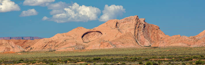
This tilted chunk of strata looks as if someone left a thumb print in it... Sinkhole of long ago.
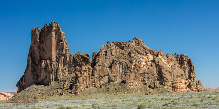
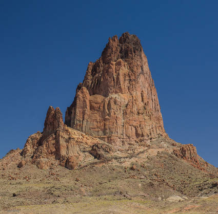
They call this one Church Rock... I guess this is where you see God.
This is the same formation. Move a few hundred yards and it is totally different.
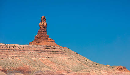
This one is called Owl Rock. Isn't that a naked lady?
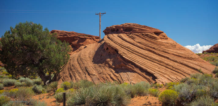
This is a lovely chunk of wonderfulness that I would love to have in my front yard. One of the cool things is that all of the rocks in this vicinity have similar \"laminations\"... and they all have that cut-off, change direction thing. in this shot, I lined the level where the pattern changes on the front rock with a rock in the background. They are all doing this on the same plane in the immediate vicinity and it is pretty cool.
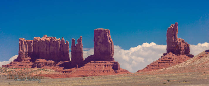
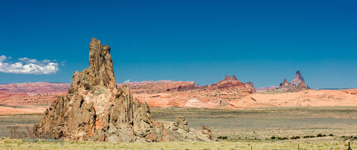
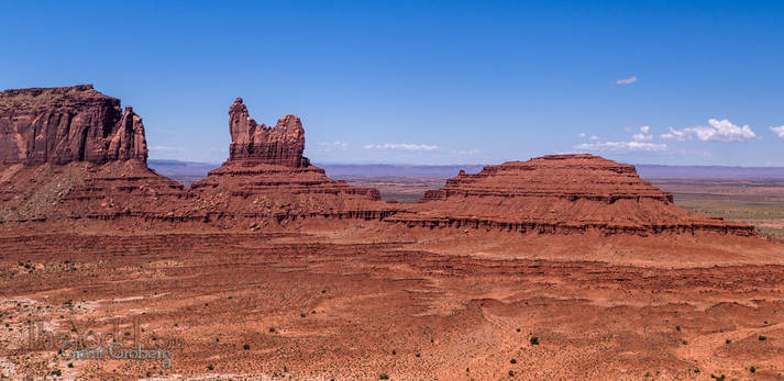
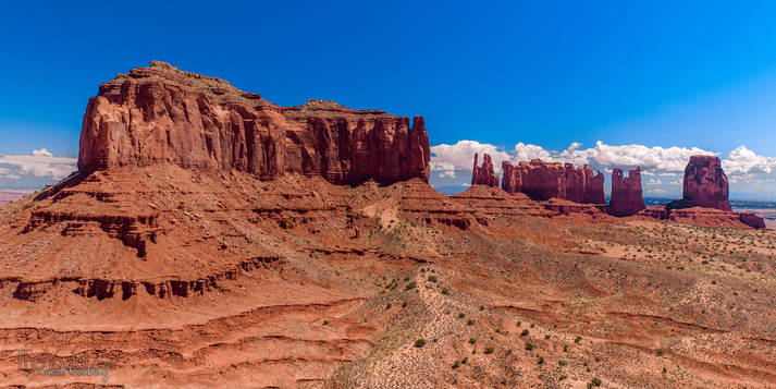
More stuff in Monument Valley
The \"Setting Hen\" Look, it's a chicken!
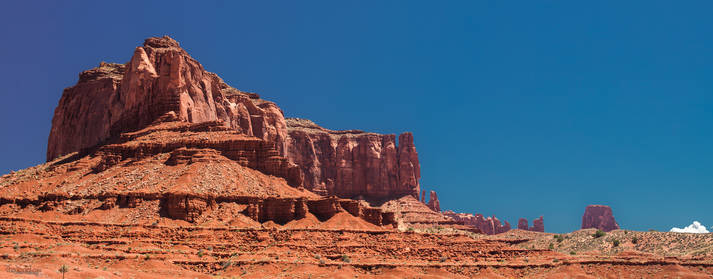
Saddleback Mesa from above ground
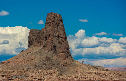
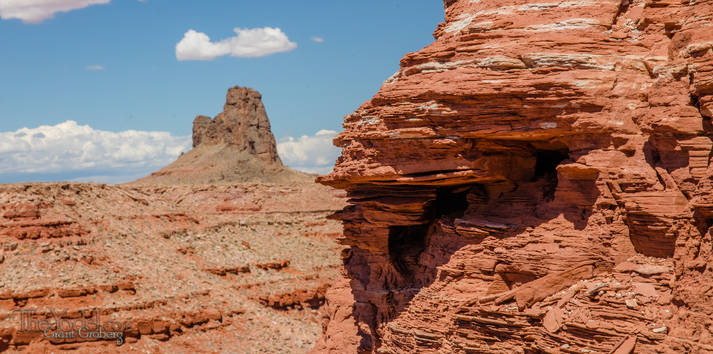
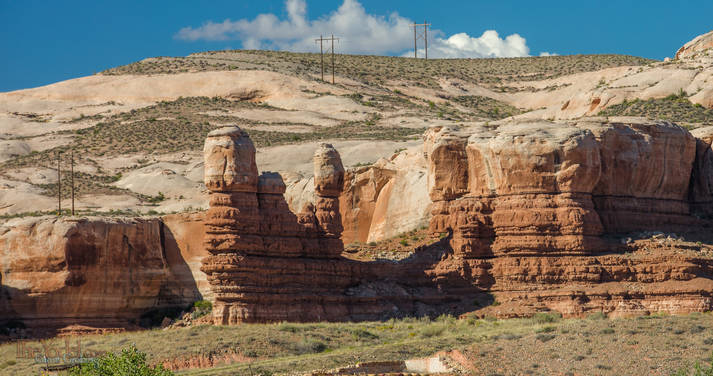
This is Alhambra Rock near Mexican Hat
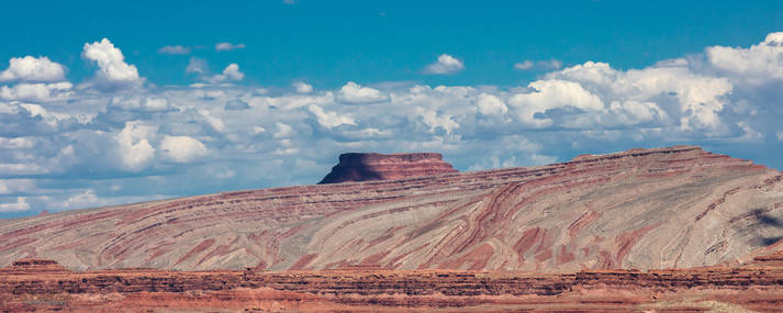
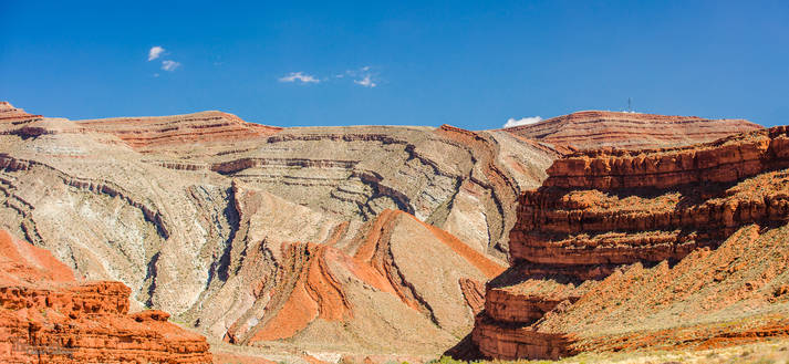
Besides being very colorful, the Raplee Ridge is fascinating, to me, because of how the strata is bending down. I wonder what the specific forces that created this structure might have been. there are pictures I took from the air below.
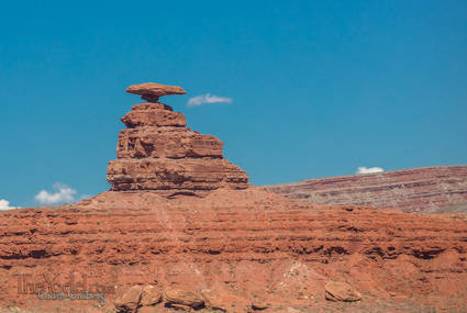
Yes, this is the famed Mexican Hat Rock
I got closer & closer to Raplee Ridge... this is shot from the ground
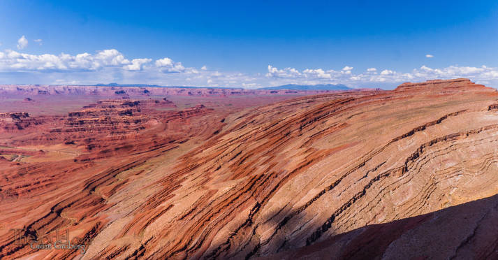
Raplee Ridge from the air it is just totally swell!
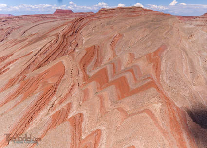
Oooh Serrations!
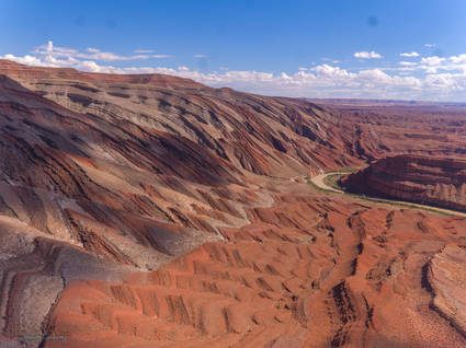
More serrations at Raplee Ridge... out of the ground and then it bends over, cool beans! Too bad for the clouds though.
And finally, some formations across the road from my motel in Bluff.
 A Utah Loop