A Utah Loop

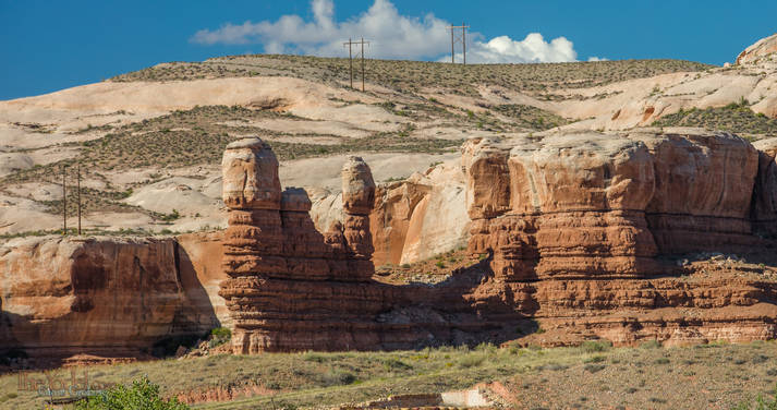
The Distance from Blanding, Utah to Bluff Utah is only about 25 miles but if you plan carefully you can make it in 200. I had planned carefully... I had planned to be responsible, put in a day and and drive from Blanding to Torrey. After all The previous day I had driven 120 miles and landed 21 miles from my starting point... I needed to make "progress" gol darn it! and 175 miles farther down the road was furthering my cause. I was less than two blocks down the road when I saw a sign that read "Mexican Hat 50 miles." Red Spire

Mexican Hat! Just the day before I was talking to a couple & heard about a really cool road between Mexican Hat and Natural Bridges... I gotta go that way! ......And then... 15 miles down the road to Mexican Hat I saw a sign that pointed to Hovenweep National Monument. "Oooh, what's that?" Cried the hopelessly digressive airhead in the car, "That sounds interesting..." and the corner was turned without another thought. But my thinking muscle came back on line & realized the sign didn't say how far this National Monument was. Time to pull over & check out the maps.

For me, maps are dangerous things. they lift the veil to the unknown.... but only just a little. They tell me that this is over there, but not exactly what this is. If you really want to know you have to google it (ha ha ha) even better go there... and maps are full of really useful information too. Such as: how far away is that unknown place. the map told me that Hovenweep National Monument was to far for an up and back trip today..... But... if I went a little further down the road and turned left onto highway 191 into Arizona and then right on highway 160 to Kayenta and then right onto highway 163 I would be able to pass right through Monument Valley on the way to Mexican Hat!

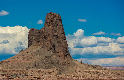
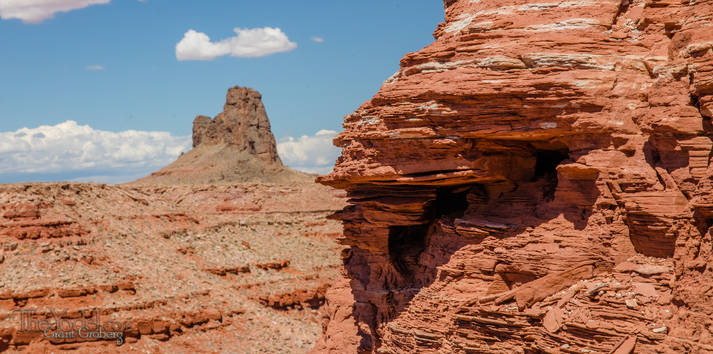
Well golly, who can say no to that? So, off I went. I had intended to stop and spend the night at Mexican Hat when I got there, but something told me to keep on. So I did... I passed a road with a sign that pointed to the "Valley of the Gods" Oooh talk about sore temptation, but the light was failing... I needed to get to a motel. Spires to be

Bluff had the place so I was set... I can visit Valley of the Gods the next day.

This tilted chunk of strata looks as if someone left a thumb print in it... Sinkhole of long ago.

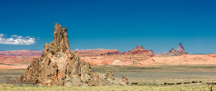
They call this one Church Rock... I guess this is where you see God.

This is the same formation. Move a few hundred yards and it is totally different.

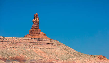
Owl Rock

This one is called Owl Rock. Isn't that a naked lady?

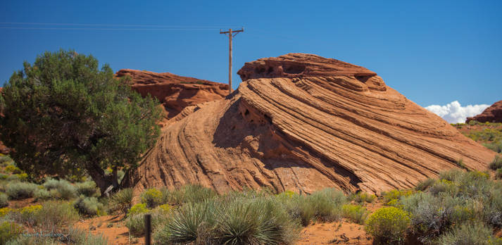
This is a lovely chunk of wonderfulness that I would love to have in my front yard. One of the cool things is that all of the rocks in this vicinity have similar \"laminations\"... and they all have that cut-off, change direction thing. in this shot, I lined the level where the pattern changes on the front rock with a rock in the background. They are all doing this on the same plane in the immediate vicinity and it is pretty cool.

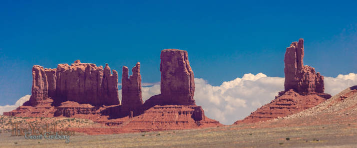
More stuff in Monument Valley

The \"Setting Hen\" Look, it's a chicken!

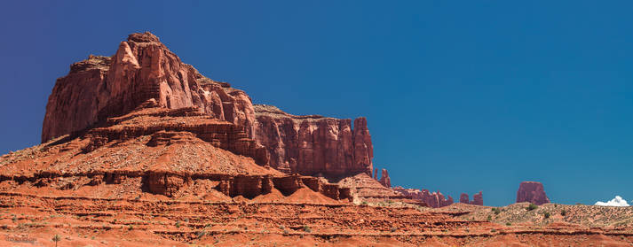
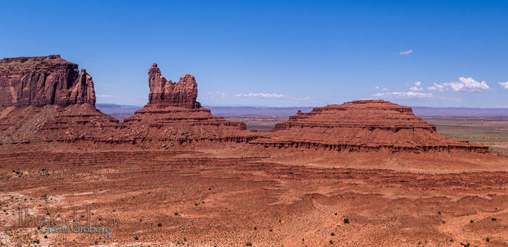
Saddleback Mesa from above ground

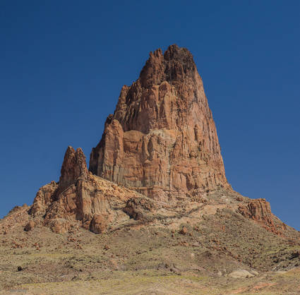
Alhambra Rock

This is Alhambra Rock near Mexican Hat

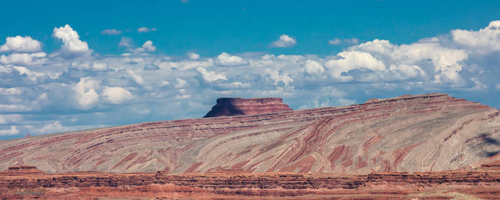
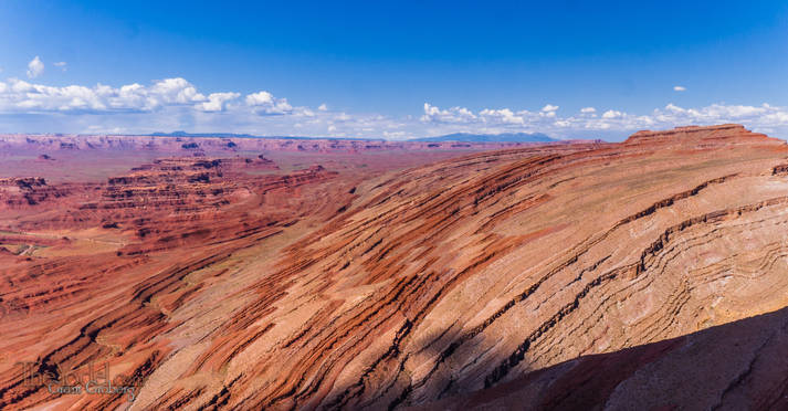
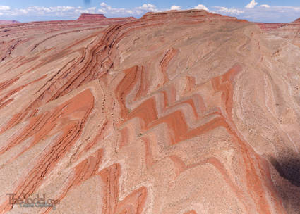
Besides being very colorful, the Raplee Ridge is fascinating, to me, because of how the strata is bending down. I wonder what the specific forces that created this structure might have been. there are pictures I took from the air below.

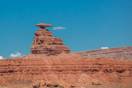
Mexican Hat Rock

Yes, this is the famed Mexican Hat Rock

I got closer & closer to Raplee Ridge... this is shot from the ground

Raplee Ridge from the air it is just totally swell!

Raplee Ridge Serrations

Oooh Serrations!

Raplee Ridge Serrations

More serrations at Raplee Ridge... out of the ground and then it bends over, cool beans! Too bad for the clouds though.

And finally, some formations across the road from my motel in Bluff.

Music
    Gerluz
        The Day We Met
        Porphero's Watch Chain
        Les Langueurs Tendres
        more...
    Gort Braggern
        Prickly Pear
        Solar Wind
        Singularity
        more...
    Sonic Landscapes
        Volcanic Sounds of the Yellowstone Caldera
        Low Tide at Soberanes Point,
        Nightbirds on the Noyo River
        more...
    Nouveau Guinea Ensemble
        Idyll
        The Tiny Jalopy
        The Bunnies Parade
        more...
Photography
      Beckwourth Complex Fire
      One Last Snow
      Let's Try a Little Winter
      more...
Travel
      Bits of VA
      Wiggling the Adirondacks
      Washington
      more...
Misc
      Mister Frank
      The Ice Follies
      House Remodel (series)
          The Remodel Begins
          Tear 'em Up
          Putting Things Back
          more..
      And Then Aug & Sep
      more...

Recent Posts
The Bunnies Parade
Aug 15, 2017
Imagine yourself walking down the street minding your own kind of business. Perhaps you are one of those who like to pull on their ear as they walk, or stroke the soft fur there. Perhaps you like to pause now and then and twitch your whiskers at everything.
Hey, Let's hit Idaho
Aug 10, 2017
So I decided to scoot over to Washington... First I had to get across Idaho.
Skipping Over the Lily Pads
Jul 27, 2017
Ah geepers, I've done it again... Calling this one "Skipping Over the Lily Pads".... The wizardry of Gerluz on the piano. Go ahead and add it to your playlists.
Monticello, Utah
Sep 05, 2016
I headed west into Manti-La Sal National Forest, there was a long, twisty route that was just about what I was looking for. Manti-La Sal National Forest, is a well-kept secret and the locals want to keep it that way. It offeres a wide variety of terrain from jush forests to arid canyon lands. One ot the swell bits is the Dark Canyon Wilderness, still a largely unexplored area.
  A Utah Loop
Out of Gunnerson, CO
Sep 04, 2016
After leaving Gunnerson, Colorado I took a detour through the San Juan National Forest.
A Layover Day in Buena Vista
Sep 03, 2016
Sometimes it's good to stop. All of those places you've been driving through... Well. People live there... Yes, they spend weeks at a time in one place... Years even, I hear tell. So if you want to feel like a real local, you have to spend at least a day in one place. I decided to settle down in Buena Vista it seemed like a nice place to call home.
Up a Winding Road and Crossing the Divide
Sep 03, 2016
I crossed the Continental Divide just to the northwest of Fitzpatrick Peak on a little dirt track called forest road 267 that runs between St. Elmo & Tincup, Colorado.
Deeper Into the Rockies
Sep 02, 2016
A dirt road is not the interstate. You can't pretend you are on the autobahn with the countryside flashing past at 150kph. You've left the fast lane, speed is an impossability. Relax, take your shoes off, roll down the windows and sniff the perfumes offered by the crisp, country air.
A Colorado Crawl
Aug 27, 2016
From Limon, Colorado I headed west. Back across the plains, through the forests of Ponderosa Pine. There was a bit of business to conduct in Castle Rock and then onward to the West. A dirt road "short cut" surpriosed me with this formation... Upended strata , almiost free standing!
The Windmills of Colorado
Aug 17, 2016
"The Windmills of Colorado" sounds poetic doesn't it? There are a whole lot more windmills in the Midwest since the last time I wandered through the area, Two of these pictures were taken from the ground... the rest from the air.
Wyoming
Aug 13, 2016
Wyoming?" You ask... "Weren't you just in Canada?" Well, um, yes... but you see... There was something I needed to get done in Wyoming,so.... "What about Montana?" You coninue, "What happened to Montana?" Montana? I love Montana, but I needed to get to Wyoming so I drove through it.
Alaskan Songbirds by Mosquito Lake
Aug 11, 2016
Mosquito Lake... sound like just the place you would want to go to on vacation.
Canadian Rockies
Aug 02, 2016
I am driving through the stunning landscapes of the Canadian Rockies. They are huge! Not just in stature, but in the volume of the area, If you are looking for an "Endless Summer" experience try driving all of the roads up here. You will discover that there will be a lot of roads yet to cover by the time the Aspen & Birch trees begin to turn.
Oh, Canada!
Jul 31, 2016
Coming into Canada the second time I was asked a lot more questions. Was I headed home? Was I going to be staying down there for a while? Whatcha got in the back of the vehicle? I almost felt I was going to be given a limited hall pass: "This guy has five (5) days to get down to the States or else we will find him and ship him south ourselves." But, after all of the questions, I was allowed in with a cheerful, "enjoy your trip."
Alaska & Out
Jul 30, 2016
OK, so you took a ferry to Alaska, spent a few days around Haines and drove up through the Yukon to the big part of the state. What now? Well... sha... drive around, find backroads, what else?
Alaska? Alaska!
Jul 29, 2016
So Where was I? Oh yeah, I was getting on a ferry to Alaska. That was three weeks and a few thousands miles ago. Ah, the romance of the high seas... "Just give me a tall ship and a star to sail her by"...
And We're Off
Jul 09, 2016
Redwood trees are socialists... Or at least very friendly. Their roots are on the surface and weave into a mat that allows them to support each other and stand against the high winds that blow through the Northwest.
  Contact
  About Us
- - - - -
Keywords in This Article

Utah
Raplee Ridge
Strata
Monument Valley
Church Rock

Unless otherwise credited, all content on TheYodel.com is
Copyright © 1999 - 2024 Grant Groberg
All rights reserved.
yup