
California's Lost Coast
There is an area of California known as the Lost Coast. Somewhere north of Fort Bragg, south of Ferndale and west of highway 101. There are a few ways to get there but fewer people who will tell you how. Some places you can drive to, much of it is accessible only by foot if at all. It is one of the remaining places that Sasquatch can run free. I found one of the routes in, a little side road that almost looked like someone's poorly maintained driveway.
I have been drawn to the Lost Coast for quite a while. Not simply because of its inaccessibility It is a fascinating area of tectonic processes that gives a thrill to the Earth Science geek in me. It is a juncture of three tectonic plates: The Pacific plate the North American plate and the Gorda plate. The Gorda Plate has been sliding under the North American plate for millions of years and this sublimation is the source of all of the fun volcanic Activity in Norther California & Southern Oregon as well as the all of the exciting earthquakes. About five million years ago the Gorda plate was a part of the Juan de Fuco plate fragment that is presently immediately north of it. About 20 million years ago they were all a part of the Farallon plate which butted against the North American plate all of the way from Mexico to Alaska. Of course there was neither Mexico or Alaska back then and the California real estate market hadn't even started. The Farallon plate has been slipping under The North American plate for over 150 million years. And you know... A lot can happen in 150,000,000 years. A lot has and I'm not going to compress it all into one paragraph here.
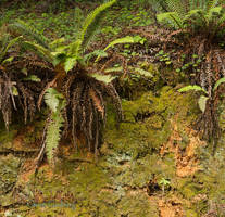
If you are lucky, you will find the road. If you are lucky, it will be sunny & clear with view that reach to forever. If you are lucky it will be drizzling & overcast with dramatic skies and moody, fog-shrouded forests. With 100 - 200 inches of rain per year, you have a good chance of it being one way or the other. In the wet spring you might spy the Native Rhododendrons in bloom or the wild Iris. The shady forests, the consistent fog and the lack of traffic allow the uphill cut of the road to host a thick matt of moss & lichen.
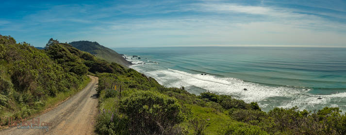
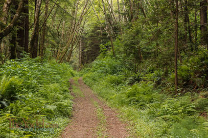
Anyhow, I discovered one of the entrances to the Lost Coast and began the drive. It is steep, a little bit rough. Beginning through second growth redwood under grown by a thick covering of ferns, this section is all privately held land, "No Trespassing" signs abound. After a while of climbing and twisting you exit the forest into steep grasslands, round another bend and are presented with a glorious view of the Pacific Ocean.
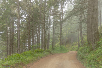
Pretty quick you are back in the forest, climbing & twisting inland again. You have to drive slow because of the road so roll the windows down and turn off the radio. Smell the forest. There are some wide areas where you can pull over and stop without blocking anyone else who might come by. Turn off your engine & listen to the birds calling through the woods. It is a pleasant silence.
It was a foggy, overcast spring day when I was last there. After some twisting I was on the outer slope of the coast again. But this time in a forest mainly of Douglas Fir that tore at the thick fog as it blew up the steep mountainside. I could hear the ocean far below. but I could only see the tops of the trees between the ocean & me and the bases of the trees up slope. I felt like I was at the edge of a precipice. Thanks to the camera GPS I now know I was 900 feet above the ocean and about 1500 feet away. It felt a lot higher and closer than that.
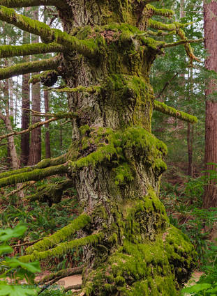
The lower branches of the trees were stubbed and broken. Shattered while battling the fierce winter storms that pummel the region every year. I imagine spending a day in the woods during one of those must be some thrill. The older trees seemed like old warriors. Battle-scarred, draped in moss, standing proud ...though some might be showing signs of a limp.
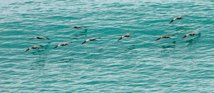
The road winds in and around, up and down the mountains. Until once again you are on an open hillside with a view of the wide ocean. From here you can see miles and miles of ocean lined by evenly spaced swells that are rolling in from the open sea. If you are lucky you will see migrating Humpback Whales or a pod or pelicans riding the updraft of the wave crests
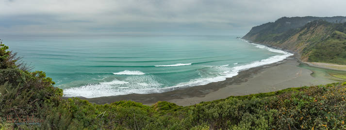
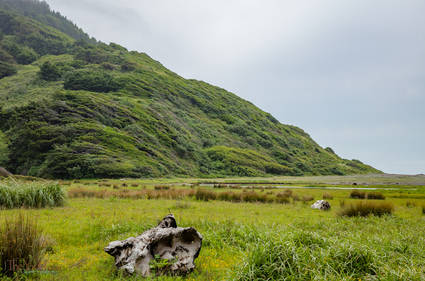
Around the next bend you have a vista upon a beautiful secluded cove with a black sand beach. Did I mention geologic coolness? The black sand is this stuff called "graywacke". Graywacke is a jumbled assortment of materials that are brought together during underwater landslides. These landslides bring matter from shallow waters to deep and over millions of years, as tectonic plates jam against each other and slide under & over, that deep water slurry gets compressed and packed. What was, in this instance, deep underwater on the Farallon plate got scraped up by the North American plate and ends up along the California and Oregon Coast as sandstone and the sandsstone erodes into these beaches. Cool beans, eh?
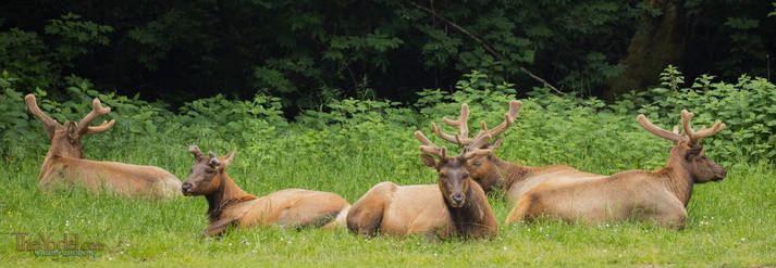
The Beach is known as Usal beach. You really don't want to go there. It is the fairly wide outlet valley for usal creek. Flattened out and with a deciduous canopy, there are camp sites, a number of trail heads. the lovely beach... You might even run into one of the resident Roosevelt Elk. Yeah... you really don't want to go there.
I'll finish off with a few random pictures of the area.
Blown constantly by the forceful ocean wind, the shrubbery that manages to gain purchase on this hillside focuses its growth down wind.
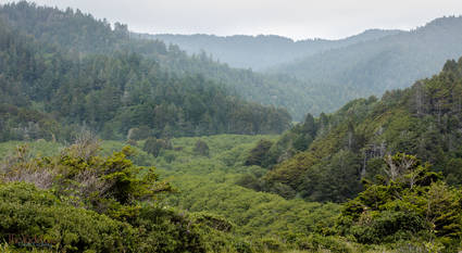
A view up the Usal Creek watershed.