Washington

Although I was headed into Washington I drove up through Idaho to enter by Moscow, Idaho. I've heard reports of the areas beauty for years... time to check it out. Moscpw, to Pullman, Wa. and head west. Many beautiful bottom valleys.

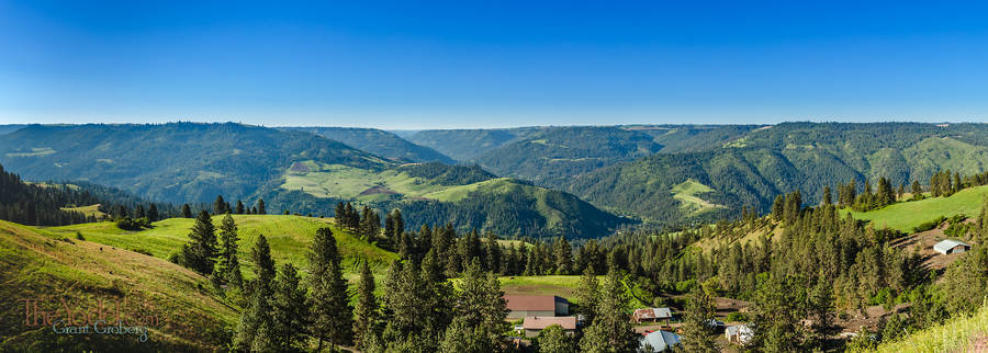
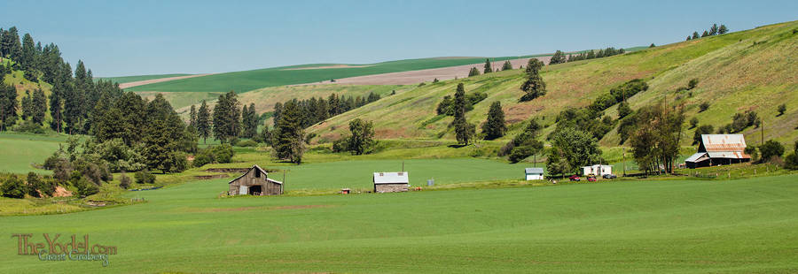
Another idyllic valley this one looks like just the right place to pull up and spend a few decades.

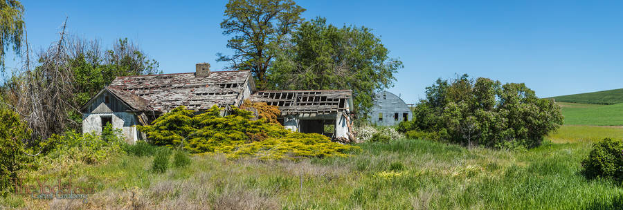
This house has been vacant for a few years. At least no one has been keeping the shrubbery trimmed.

This view is looking across the Clearwater River, South toward Peck Idaho. Though the area has a mountainous feel there are no mountains here. These valleys are carved out a dead-flat plain that is composed of layer on top of layer of basaltic lava flows that were deposited over millions of years.

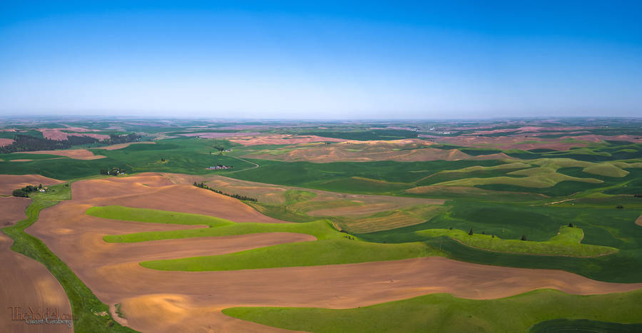
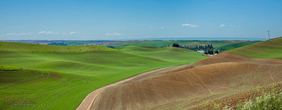
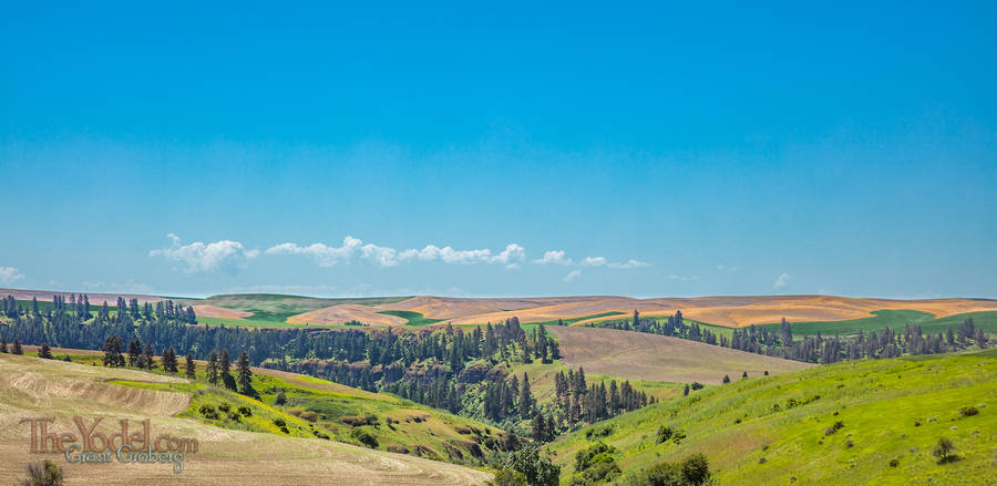
Back to Washington.... Above those lovely river bottoms there are endless vistas of rolling hills. The Farmers here plant in rows that contour the hillside.

Of course from the ground all you can see is the top of the next hill. But if you set the timer on your camera and throw it up into the air just right you can see how they bubble off to the horizon.

Some hills are taller than others... This picture was taken from the ground. Well, the roof of my vehicle, actually...
Looking over toward one of the lovely river bottoms from the bubbly hilltops.

Why Washington?

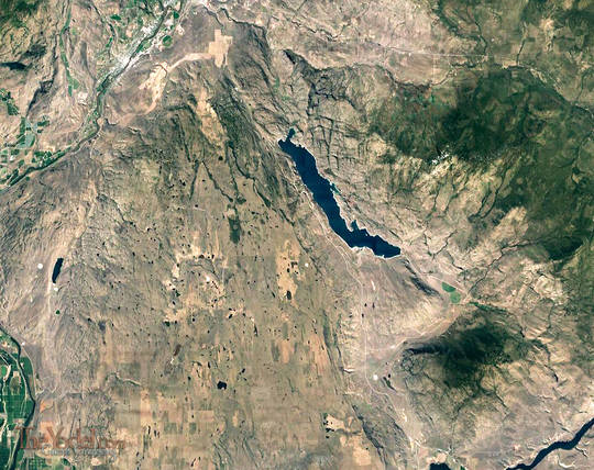
This is a satellite image of the reason I was headed into Washington this time. What you are looking at is evidence of repeated catastrophic flooding events. This is how the theory goes: During the ice ages of 13k - 15k years ago, massive glacial lakes formed during the melts and when they let loose a sudden barrage of water. They estimate that the largest of these was the equivalent to 13 Amazon rivers and they weren't selling any books.

So use your imagination a little. The floods were coming in from the top of the image. Perhaps at first the flood fanned out over the plain tearing up as much as it could. Then in the area over to the right a fissure in one of the basaltic layers gave out... maybe there was a cavern underneath carved out by millennia of seepage, and the weight of the water caused it to fail creating a deep channel that pulled away most of the water... well I took a few more pictures of what I saw...

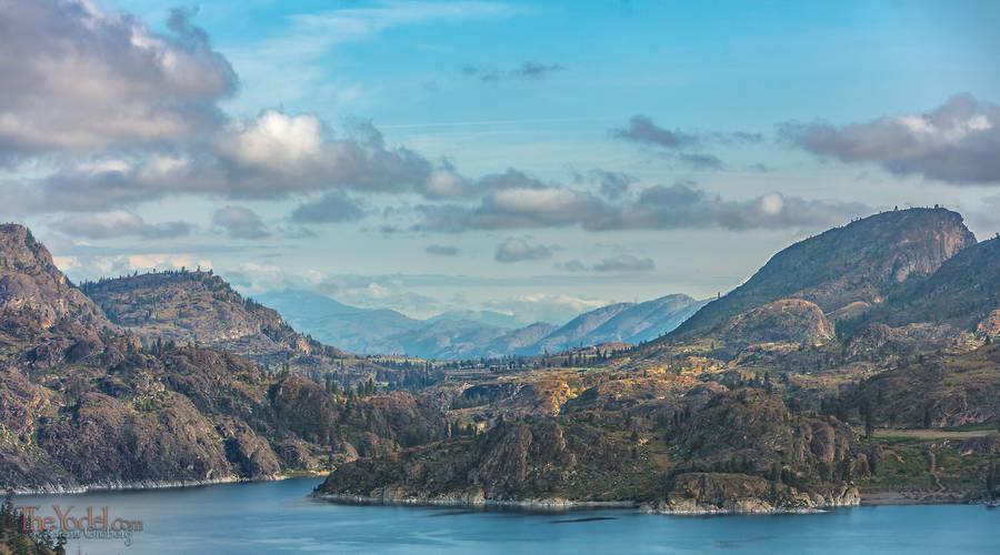
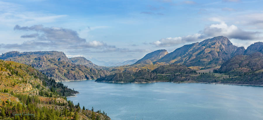
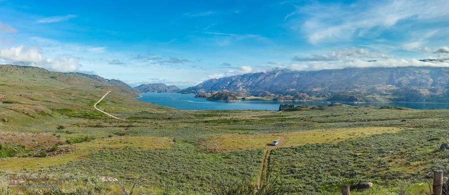
This is the North end of Omak lake. See that nice valley there... Imagine it filled to the brim with water...Not nicely flowing water. That valley was empty a minute ago. It is now raging. Overflowing with a cataclysmic volume of water.

And it's not just that channel, there is more water flooding in from the left of the picture. Are you running yet?

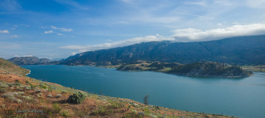
Nowadays, Lake Omak is a saline lake it is few by three streams but there is no outflow. The floods carved out a good hollow. Are you still running? I think we had better get to some high ground.

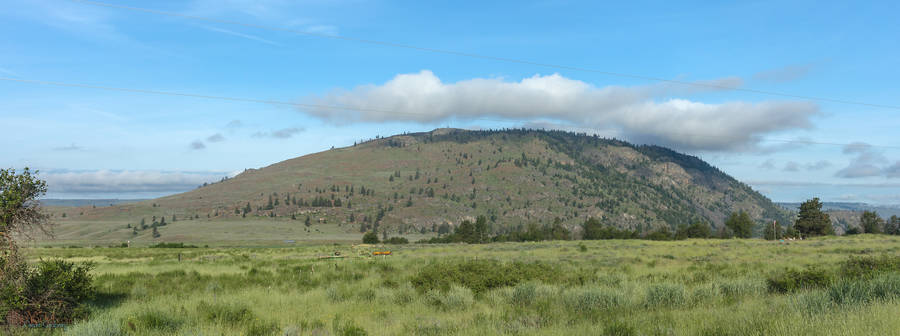
OK, we are above the lake. Churning around through the pit of the lake has caused the water to dissipate a lot of its energy and the channel is wider here so we should be safe, right?
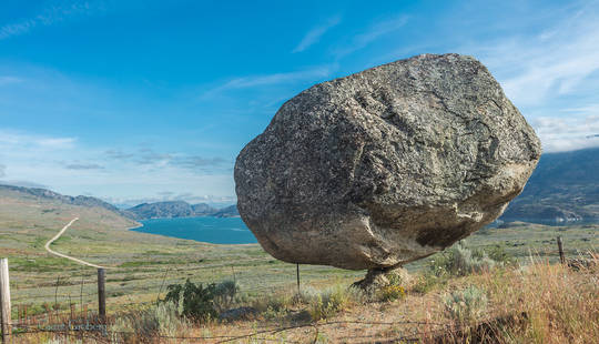
Wait, maybe not

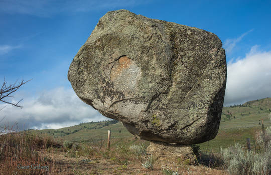
Maybe we are not safe up here. Even though we have climbed a few-hundred feet up this hill, the flood has deposited a few dozen of these van-sized granite boulders up on the hill. This one happened to rest on a nice pedestal.

The flood was blasting from the right to the left.

Balancing Rock

Another view of the balancing rock.

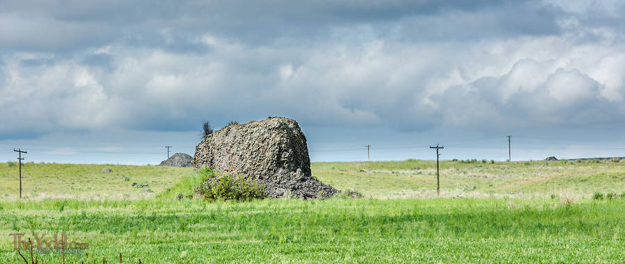
And then I went up to the plateau on the left half of the satellite image. At the North end of the plateau there are house-sized chunks of basalt that were left behind as the flood lost the energy to keep them moving.
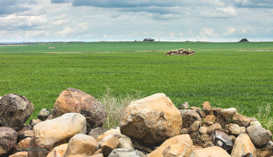
What do you do when you have giane chunks of ston in your fields? you mow around them.

Stone Piles

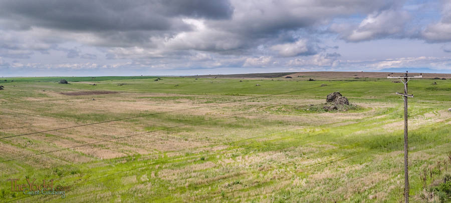
As you travel further to the south the boulders left behind are smaller and the farmers can assemble them into nifty piles.
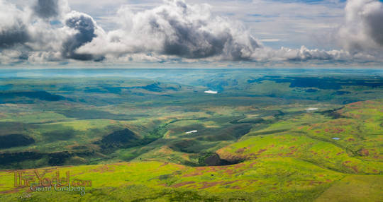
Columbia River

This was taken a few hundred feet up. from just about the bottom of the satellite image just left of the middle I am looking south-east, upstream intoteh columbia river basin.

This is looking Westward, The Columbia river is to the left. Notice how everything is carved out of an incredibly flat plain. running up to the right of the frame is the basin of the Okinogan River. It is considered that long ago the Columbia river flowed down that channel being diverted way up in Canada. I think I willgo over there for the next picture.

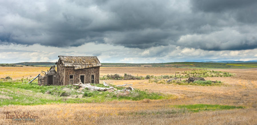
Yep, another old wrecked house.

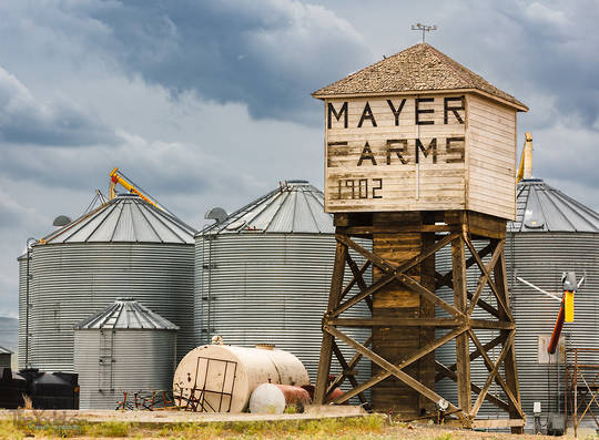
Mayer Water Tower

And of course there are the water towers. we mustn't forget the water towers.

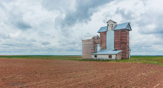
Grain Elevator

And a patient, old Grain Elevator.

Music
Photography
Travel
      Bits of VA
      Wiggling the Adirondacks
      Washington
      Hey, Let's hit Idaho
      A Drive About (series)
          And We're Off
          more...
      West Highway 162
      A Jaunt to Nevada
      Coffee and Pie (series)
          Branson to Fayetteville
          more...
Misc

Recent Posts
Ring Ring (the telephone rings)
Oct 26, 2018
Ring, ring,     the telephone rings, but we're not near to answer.
Wiggling through the Adirondacks
Oct 18, 2018
Moseying about again... I had intended to head into the Northern parts of Quebec but once I arrived in Montreal, the Canadian weather informed me that only a fool would head up there in late October without a warm coat.
Selfie
Apr 20, 2018
Goodness gracious! Am I doing techno now? Well I decided to write something that you could dance to... or maybe a little bit of head-bobbing. It gives me a chance to use robots in the cover art.
  Washington
The Bunnies Parade
Aug 15, 2017
Imagine yourself walking down the street minding your own kind of business. Perhaps you are one of those who like to pull on their ear as they walk, or stroke the soft fur there. Perhaps you like to pause now and then and twitch your whiskers at everything.
Hey, Let's hit Idaho
Aug 10, 2017
So I decided to scoot over to Washington... First I had to get across Idaho.
Skipping Over the Lily Pads
Jul 27, 2017
Ah geepers, I've done it again... Calling this one "Skipping Over the Lily Pads".... The wizardry of Gerluz on the piano. Go ahead and add it to your playlists.
A Utah Loop
Sep 05, 2016
The Distance from Blanding, Utah to Bluff Utah is only about 25 miles but if you plan carefully you can make it in 200. I had planned carefully... I had planned to be responsible, put in a day and and drive from Blanding to Torrey. After all The previous day I had driven 120 miles and landed 21 miles from my starting point... I needed to make "progress" gol darn it! and 175 miles farther down the road was furthering my cause. I was less than two blocks down the road when I saw a sign that read "Mexican Hat 50 miles."
Monticello, Utah
Sep 05, 2016
I headed west into Manti-La Sal National Forest, there was a long, twisty route that was just about what I was looking for. Manti-La Sal National Forest, is a well-kept secret and the locals want to keep it that way. It offeres a wide variety of terrain from jush forests to arid canyon lands. One ot the swell bits is the Dark Canyon Wilderness, still a largely unexplored area.
Out of Gunnerson, CO
Sep 04, 2016
After leaving Gunnerson, Colorado I took a detour through the San Juan National Forest.
A Layover Day in Buena Vista
Sep 03, 2016
Sometimes it's good to stop. All of those places you've been driving through... Well. People live there... Yes, they spend weeks at a time in one place... Years even, I hear tell. So if you want to feel like a real local, you have to spend at least a day in one place. I decided to settle down in Buena Vista it seemed like a nice place to call home.
Up a Winding Road and Crossing the Divide
Sep 03, 2016
I crossed the Continental Divide just to the northwest of Fitzpatrick Peak on a little dirt track called forest road 267 that runs between St. Elmo & Tincup, Colorado.
Deeper Into the Rockies
Sep 02, 2016
A dirt road is not the interstate. You can't pretend you are on the autobahn with the countryside flashing past at 150kph. You've left the fast lane, speed is an impossability. Relax, take your shoes off, roll down the windows and sniff the perfumes offered by the crisp, country air.
A Colorado Crawl
Aug 27, 2016
From Limon, Colorado I headed west. Back across the plains, through the forests of Ponderosa Pine. There was a bit of business to conduct in Castle Rock and then onward to the West. A dirt road "short cut" surpriosed me with this formation... Upended strata , almiost free standing!
The Windmills of Colorado
Aug 17, 2016
"The Windmills of Colorado" sounds poetic doesn't it? There are a whole lot more windmills in the Midwest since the last time I wandered through the area, Two of these pictures were taken from the ground... the rest from the air.
Wyoming
Aug 13, 2016
Wyoming?" You ask... "Weren't you just in Canada?" Well, um, yes... but you see... There was something I needed to get done in Wyoming,so.... "What about Montana?" You coninue, "What happened to Montana?" Montana? I love Montana, but I needed to get to Wyoming so I drove through it.
Alaskan Songbirds by Mosquito Lake
Aug 11, 2016
Mosquito Lake... sound like just the place you would want to go to on vacation.
Canadian Rockies
Aug 02, 2016
I am driving through the stunning landscapes of the Canadian Rockies. They are huge! Not just in stature, but in the volume of the area, If you are looking for an "Endless Summer" experience try driving all of the roads up here. You will discover that there will be a lot of roads yet to cover by the time the Aspen & Birch trees begin to turn.
  Contact
  About Us
- - - - -
Keywords in This Article

Washington
Idaho
Flood
Missoula floods
Omak
Valley
Bottom

Unless otherwise credited, all content on TheYodel.com is
Copyright © 1999 - 2025 Grant Groberg
All rights reserved.
yup